
Crow’s Nest: Ursinus College curriculum development
By Daniel Barringer, Preserve Manager.
I had the pleasure over the last year to participate in a group planning multidisciplinary courses at Ursinus College, ones designed to draw upon science and humanities expertise in studying land use changes—and our perception of them—in the area around Collegeville, Pennsylvania.
Undertaken with a National Endowment of the Humanities grant the team—drawn from the English, Environmental Studies, History, and Biology Departments, students, and members of the community—explores issues of space, place and nature in today’s suburbia.
Students in these courses will be documenting the changes in these cultural landscapes and asking questions about what these transitions mean for the people who inhabit these places. It is easy for us who live here to take for granted that things are the way they are, but today’s community conditions are the direct result of policies and decisions based on people’s values. What factors drive those decisions?
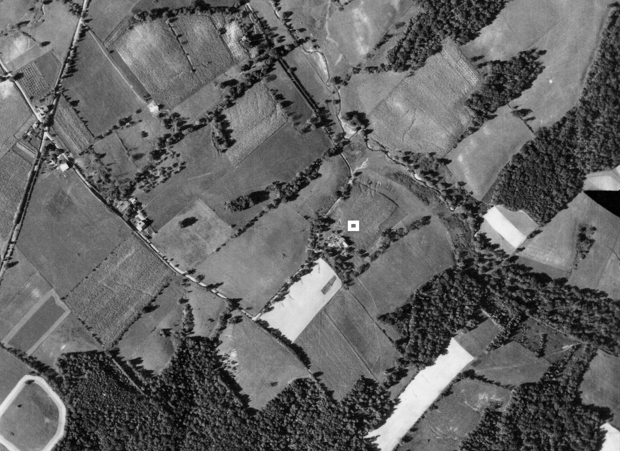
1937 Aerial photo of Chester County. www.pennpilot.psu.edu
The area around Collegeville, Montgomery County, has undergone waves of suburbanization, each one exhibiting different patterns of settlement that leave a distinct signature on the land. Nature isn’t absent from theses landscapes, but it is different from the rural landscapes that preceded them. Only surprising at first thought, forest cover is much greater today in the suburban neighborhoods than it was on the farms upon which these subdivisions were built, with corresponding effects on the numbers and composition of wildlife species.
Scholars believe we have entered the Anthropocene, the age when humans have the greatest influence on the Earth’s biological and physical systems. Even when we try to “protect” nature we have a profound influence on species and natural communities. What was new to me in the readings for this coursework is the political ecology perspective that what we choose to protect, and for whom, reflects implicit values that have a greater impact on human communities than is immediately visible. It asks the questions: What are we protecting? Who benefits? What era of history are we recreating in the landscape when we “restore” the land? Who gets to tell the story? To me these are profound questions for a land trust to ask itself if we intend for our work to benefit as many people as possible and ensure egalitarian access.
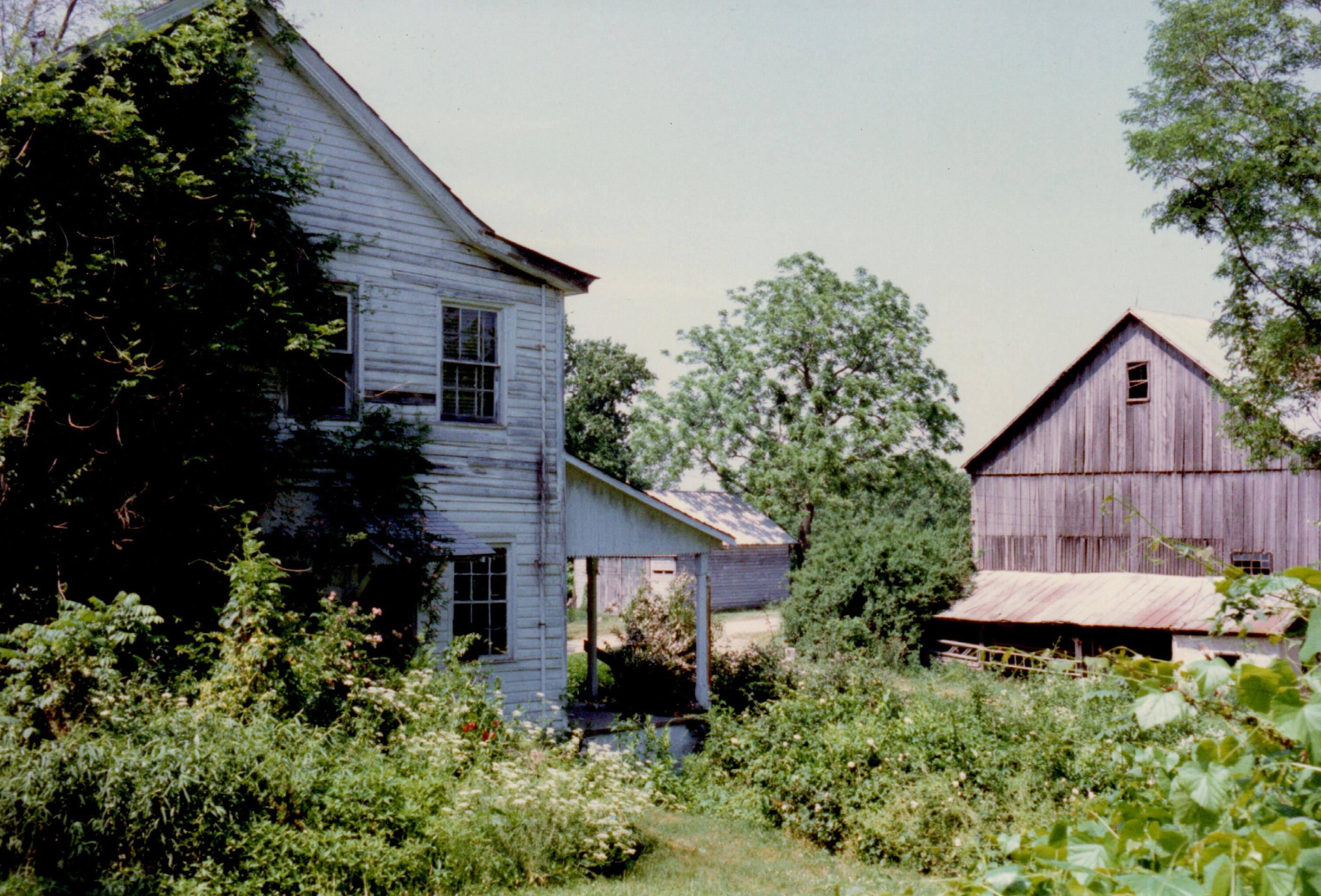
Family farm in the early 1970’s, in Dan’s story map about land use history
Tools students will use in the coursework include Geographic Information Systems (GIS) and ArcGIS Story Maps—interactive web pages that can show changes in demographics and land use over time. As part of my exposure to the technologies I prepared a kind of story map of a family farm in southern Chester County that once belonged to my great aunt and uncle and is now a residential development.
Books being investigated for the course include James and Nancy Duncan, Landscapes of Privilege; Keneth T. Jackson, Crabgrass Frontier; Paul Robbins, Lawn People; and John M. Marzluff, Subirdia (yes, that’s spelled correctly).
One outcome of the project is that Ursinus students will visit Natural Lands Preserves to see how we balance conservation and community values, how our preserves support diversity, and what factors influence our decisions on what resources to protect and manage. I’m very excited about this collaboration.