
Crow’s Nest: Autumn scenes
By Daniel Barringer, Preserve Manager.
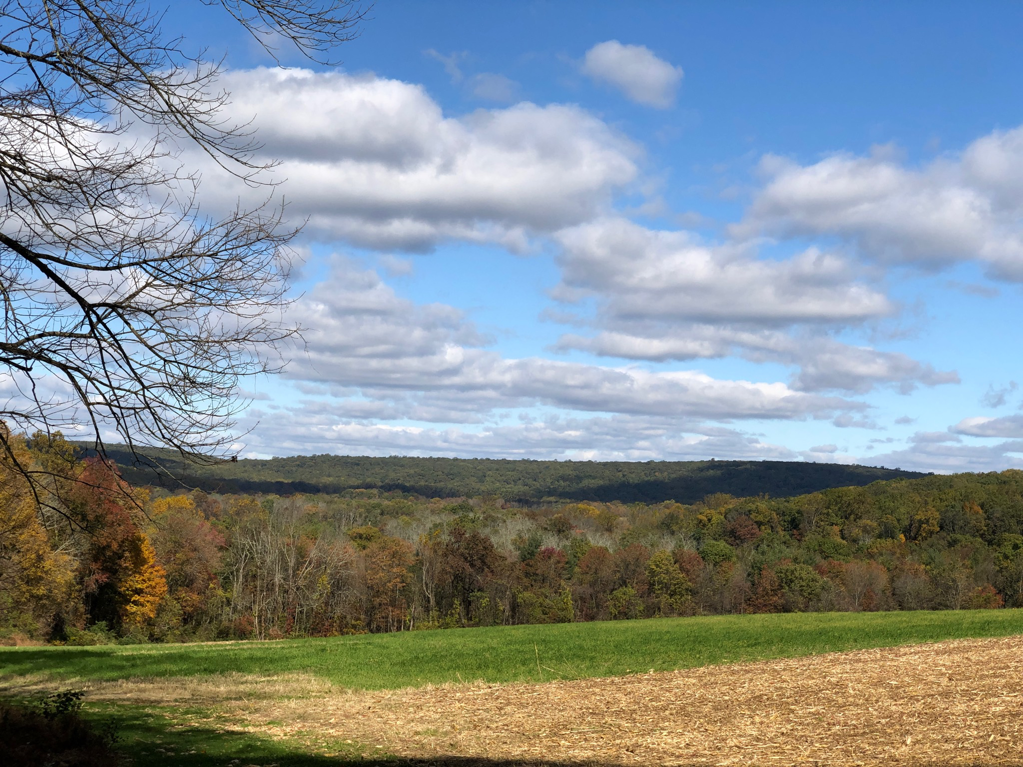
Visitors to the preserve often say that they value the vistas; here is the one from Northside Road looking north. The valley is Crow’s Nest Preserve and the far ridge is Buzzard Hill in French Creek State Park. We’re running a little late on fall color this year; I usually say that our peak is around the 2nd week of October, around the 14th. We’re not there yet, but this week should be very good for leaf-peeping. We had our first frost of the year on Friday night with milder temperatures since then.
The dead trees in the valley above are ash trees killed by Emerald Ash Borer. While we’re removing ash trees that are located along the roads, we’re letting nature take its course in the floodplain forests where ash once dominated. We may not like all of the changes but this is the reality we face.
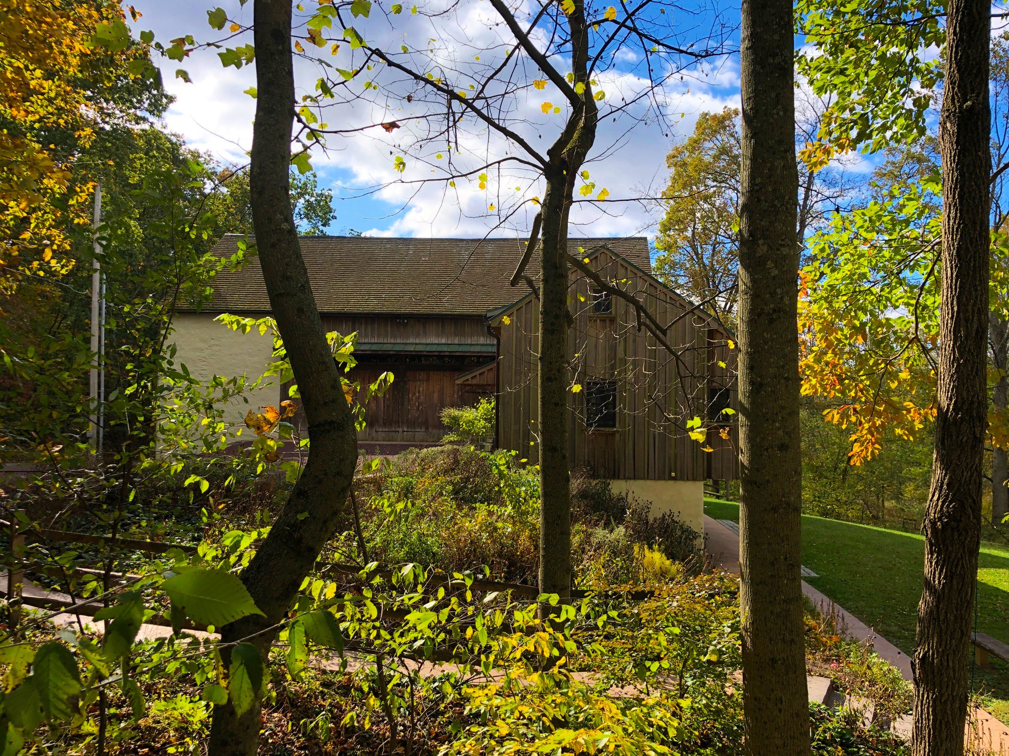
Here’s a view of the visitor center barn as you approach from the parking lot, or at least close to it—I was on a ladder fixing the light strings after last week’s heavy winds.
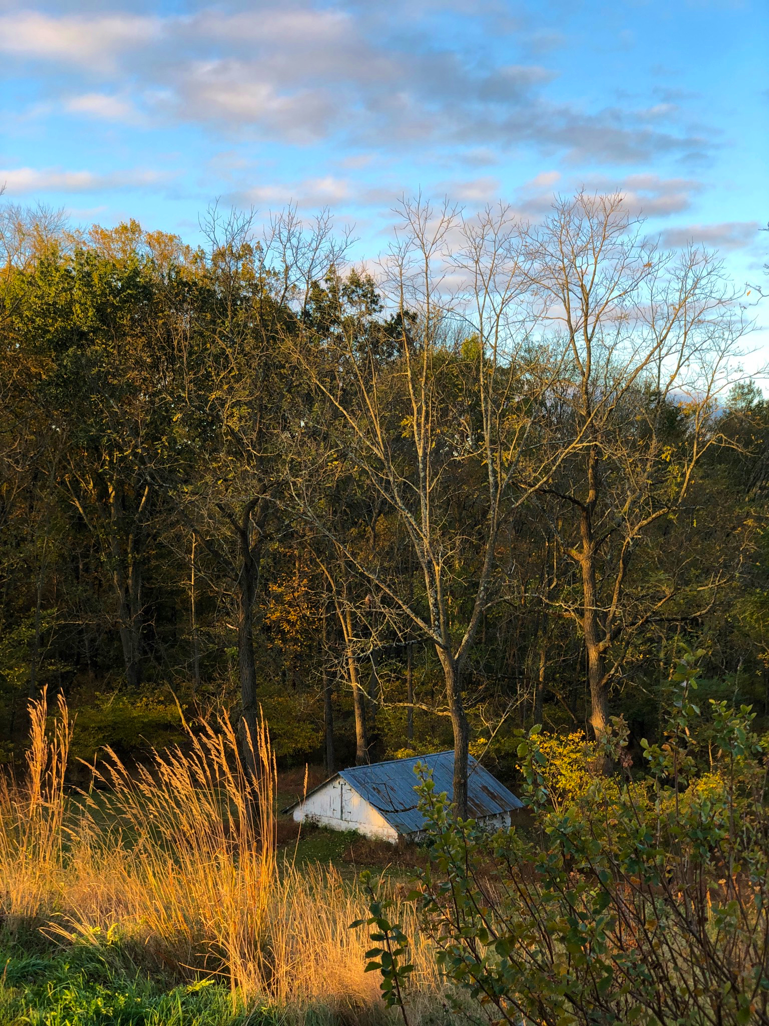
Grasses create a good bit of fall interest even after the trees lose their leaves.
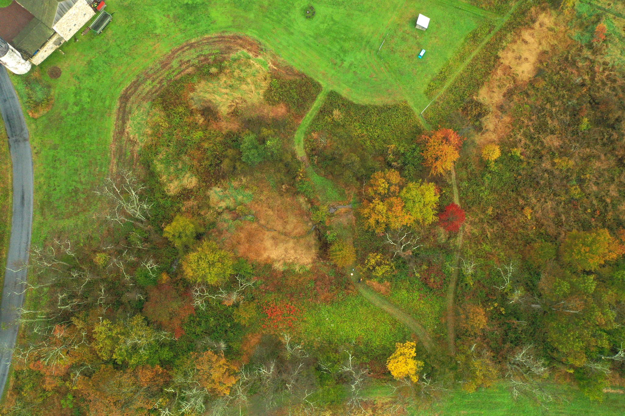
Finally, here’s landscape as abstract art. Volunteer Mark Williams flew a drone here over the weekend to collect baseline data for the pond dam removal project. The farm pond was once located in the area at the center of this photo, now an area of brown grasses.. Wetlands and restored streams are better for wildlife and water quality than artificial ponds, and since the dam was destroyed we have an opportunity to contour the land back to what it likely was before the earthen dam was built.
That’s the maintenance center barn at top left with the silo visible; at top right is a shed we use for the calves and their blue water trough. At top center is a little fire pit and benches. Mark and I are standing just below the center of the photo at roughly 4 o’clock.
I’m very proud of how the area around the pond has grown up in native vegetation; I wish we had a drone photo of this area from 20 years ago for comparison. I’ve gradually let the lawn go back to meadow, selectively removing multiflora rose and vines so that the area has filled in with alder, swamp rose, buttonbush, walnut and oak trees. The trail that crossed the pond dam is clearly visible, as is the weed-whipped perimeter of the cattle fencing. The bare trees in this photo are black cherries (Prunus serotina) that have already lost their leaves this fall; they’re not dead—though they aren’t in the greatest shape.
The stream has already cut itself a bed through the silt of the former pond. The restoration that will take place here over the next several months involves removing the pond dam (with the associated 8 foot-deep notch that the stream cut through it) and armoring the banks of the new stream with rocks, and adding rocks to step the stream down from the height of the former pond entrance to its new, much lower exit. The restoration project is being funded by a grant from the U.S.D.A. Natural Resources Conservation Service.
Later we will replant the banks of the stream with native trees and shrubs. Admittedly while under construction this area will get uglier before it improves again; we’ll use the drone photography to document the changes and guide us in replanting decisions. Eventually we’ll reopen the trail which used to cross the pond dam, using a footbridge to span the newly-created creek there.