
Crow’s Nest: altitude stories
By Daniel Barringer, Preserve Manager.
When I walk the dog in the morning I can feel the temperature rise as my feet take me from our house on the preserve (482 feet above sea level, or ASL) to 568′ ASL at the intersection of Hopewell Road and Piersol Road. I realize there are vegetation changes as well as elevation; our house is surrounded by farm fields and the intersection at the end of the street is in woods that continue uphill into French Creek State Park. I think that open areas tend to radiate more heat away overnight, but I think the temperature change is also sometimes from the ~66 feet of elevation change.
I think of our house as sitting above the surrounding landscape, since we look across the valley as it descends to French Creek that runs through the middle of Crow’s Nest. But really, we’re on only a small knoll and the whole preserve is surrounded by much higher elevation in the surrounding state park. Cold air sinks overnight and settles in the lower lands, so that 66 feet of elevation change may make a difference. I wonder if I continued to climb up Buzzard Hill from its base at this intersection to the top (905′ ASL, or an additional 337 feet). I wouldn’t likely be able to observe this without taking measurements since the effort of the climb would itself warm me up.
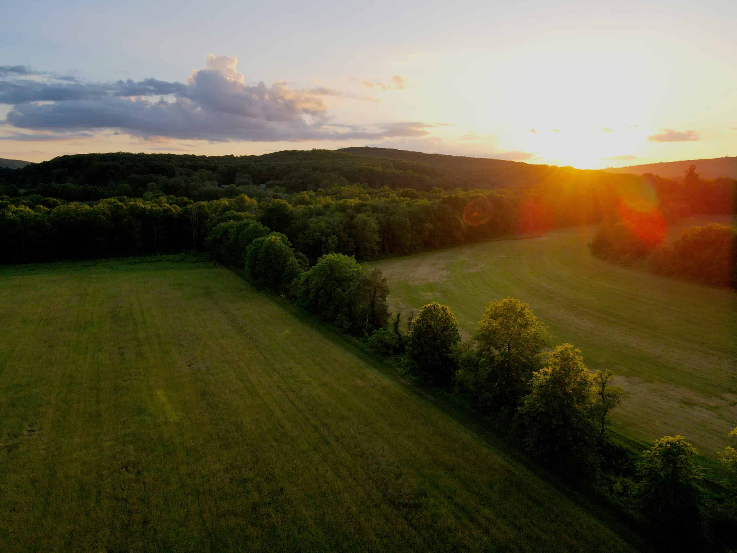
Photo: Daniel Barringer
Where French Creek flows into the preserve under a bridge on Bethesda Road the bank is at 446′ ASL; where it leaves us under Trythall Road the land is at 433.’ That minor 13′ of elevation change over a distance of ~0.8 miles as the crow flies is why the creek meanders through the floodplain here, in contrast to the falls of French Creek at St. Peter’s Village where it tumbles over rocks and pools to descend to Knauertown (more than 130′ lower than Crow’s Nest). What about the headwaters of French Creek? At the outflow of the dam of Hopewell Lake (presumably the natural elevation of the stream before it was dammed, about 492′ ASL). At the upstream end of the artificial lake, about 505′ ASL. (I guess that means we can assume most of the lake is not much more than 13′ deep, right?) The tributary that flows from Scotts Run lake, upstream from Hopewell Lake is a major source for French Creek, and the elevation at the high end of that lake is about 590’—so the headwater springs that feed French Creek are almost 200′ higher than Crow’s Nest.
Of course French Creek drains almost twice as much watershed (~9 square miles) when it leaves the preserve as when it enters (about 5 square miles), as it adds the tributary of Pine Creek and the lands that drains. Not surprisingly, the lowest point on the preserve is where French Creek leaves the preserve (433′ mentioned above). But what about Mine Run which also flows though the preserve south of Fox Hill and Northside Road? Turns out that valley is perched higher than the main branch of French Creek here, as that creek leaves the preserve at 505′ and doesn’t reach French Creek until just above St. Peter’s Village.
The Visitor Center barnyard is at 462′ ASL. Fox Hill is 633′ AGL, Monocacy Hill (across Piersol Road from the visitor center) is about 640′ ASL, which makes it the highest point on Crow’s Nest Preserve. The total elevation change of the preserve therefore is 207 feet. Many of these hills are wooded, so only afford a view in winter, and limited even then.
The highest points around us in the state park are Buzzard Hill (905′ ASL), Mt. Pleasure (872′), and the base of the hill with the fire tower on it is 997’—not surprisingly, the highest point around. (The tower, reportedly 80′ tall and built in 1935, may not be located at quite the highest point on the hill—more like 980′ ASL.) The view from there is great (normally closed, the Pennsylvania Department of Conservation Bureau of Forestry—which operates the tower during extreme fire weather—gave our campers a tour in 2006, two at a time, due to weight restrictions). On a clear day you can see the fire tower on the Blue Ridge above Hamburg, for good coverage of all the forests in between.
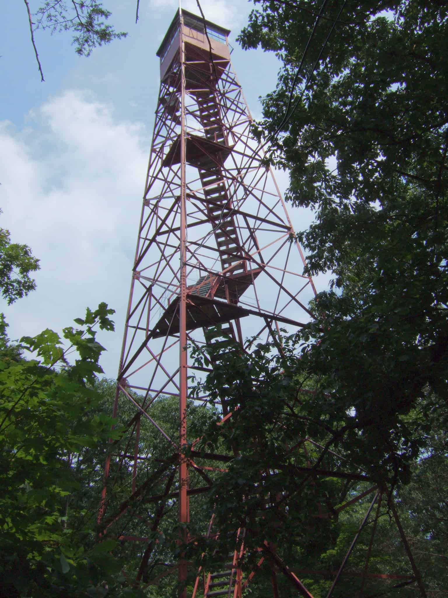
Photo: Daniel Barringer
You can gather approximate elevation from a U.S. Geological Survey contour map, or you can use an app or a website. I referred to FreeMapTools.com Elevation Finder for several of these numbers.