
Hopewell Fire plus four weeks…
It has been four weeks since the Hopewell Fire broke out during an extremely dry spell and burned for more than five days in French Creek State Park. What a difference a few weeks makes, now it rains every day and I can’t get the lawn mowed!
My son Owen and I went for a hike along a portion of the forest fire area I hadn’t seen while fighting it; I wanted to see how some of the ~700 acres were responding. We parked at the Shed Road parking area and walked in on the Mill Creek Trail at the top of the hill. What amazes me the most is that more didn’t burn. Normally fire spreads rapidly uphill, but the fire didn’t even make it to the Mill Creek Trail for the first mile in. Some of this is because the wind was driving it across the hillside to the east, but also it didn’t burn all the way up the hill due to the hand-dug firebreaks crews put in there.
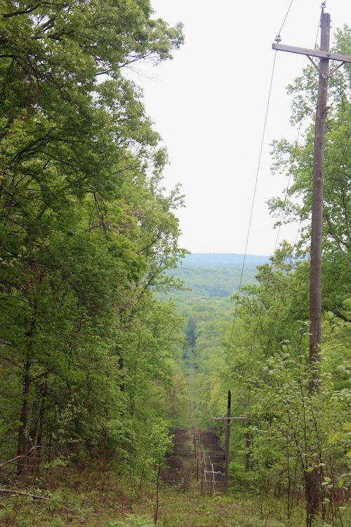
Here’s a view of the powerline right-of-way where the fire is believed to have started. From below I had assumed it had burned to the top of the hill, but it was a ten minute stroll from the top of the hill down to the highest point the fire reached. But remember, wildfires usually take on a teardrop shape with the narrow tip at the point of origin. So it makes sense that this was a narrow section (and also—but for hard work, that it might not have been).
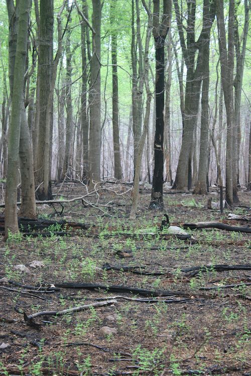
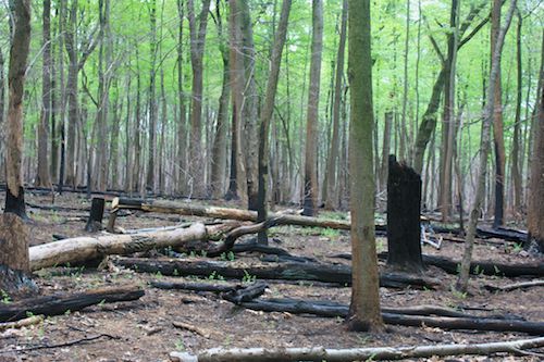
Many plants are already resprouting on the forest floor. Notably absent are the fine dead fuels that carried the fire. Remember that last October’s snowstorm brought down a lot of tree tops that added to the fuel. Repeated years of gypsy moth outbreaks meant that there was a lot of dead wood in this forest.
The canopy is leafing out. Large trees that had lower branches don’t have leaves on them any more.
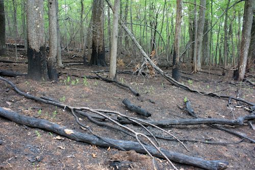
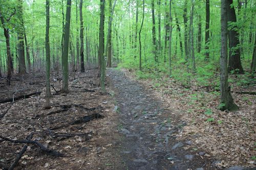
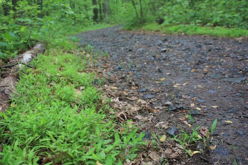
Some of the existing trails were successfully used as firebreaks. A section of the Mill Creek Trail held as shown below:
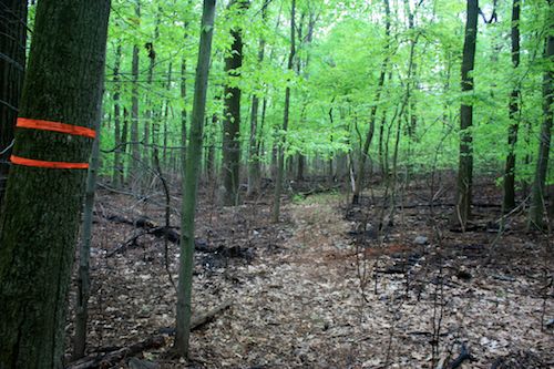
You can also observe spots that slopped over part of the trail where a quick firebreak was dug around the slopover that contained it. Exciting times for those involved.
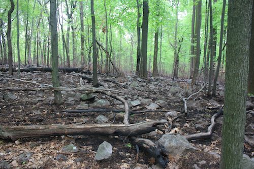
Below appears to be a rapidly constructed firebreak that did not stop the fire. Spots on the far side joined together and the fire continued on.
The leaf litter is absent revealing the surface geology.
One mountain biker who passed us and exchanged a few words appeared not to be aware that this forest had just experienced wildfire.
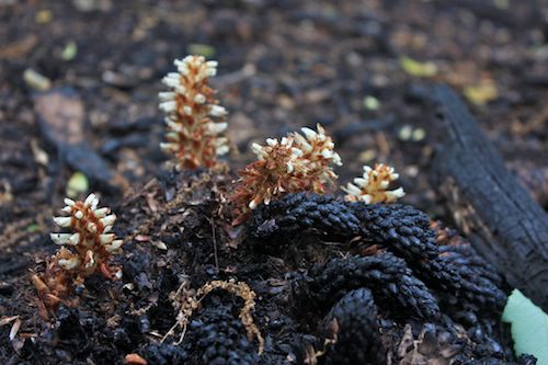
Among the plants sprouting from the forest floor are hay-scented fern (Dennstaedtia punctilobula), pokeweed (Phytolacca americana), and black cohosh (Actaea racemosa)—or for us old-timers (Cimicifuga racemosa). And the squaw-root (Conopholis americana), a parasitic plant that is associated with the roots of oak and beech trees, is flowering over its earlier-charred stems.
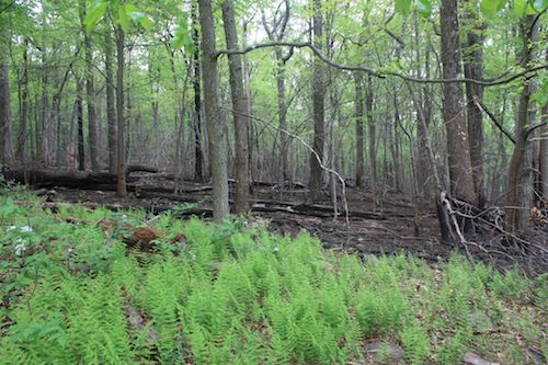
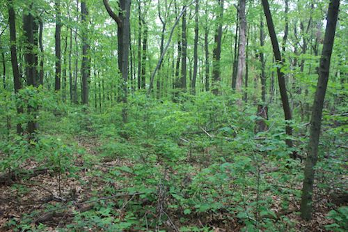
The shrub and sapling layer is largely absent right now from the burned area. Regeneration should be good. I was told that white-tailed deer numbers are low enough that deer browsing won’t inhibit regeneration. For some of the forest this is clearly the case:
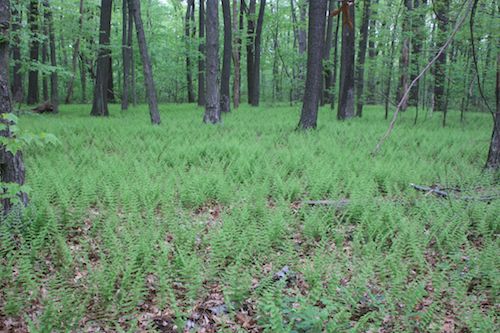
Other parts resemble a “fern desert” of hay-scented fern. But this could be an artifact of an earlier, larger deer population. Hay-scented fern is not preferred by deer and where you see an understory of only this fern you can guess there’s a high deer density. But hay-scented fern is also very competitive (if not allelopathic) so where it has become well established it may inhibit regeneration even after the deer numbers have declined.
The remaining open question is how much other invasive species will benefit from the disturbance of the burn. Already Japanese stiltgrass (Microstegium vimineum) lined both sides of many trails in the park, probably brought in by seeds lodged with mud in hikers’ boots’ lugs. It’s a species thought to thrive under the conditions created by fire, so we will likely be seeing more of it in the park.
Owen and I made it to Miller’s Point but not down to the Mill Creek in the valley below. The fire didn’t sweep over the rocks at Miller’s Point but it definitely passed it to the south and made it into that bowl of a valley and up the next ridge toward St. Peter’s Road. Seeing the next division of the fire will wait for another day, and eventually we’ll make it back to the Buzzard and Lenape Trails where I spent a couple days last month.
By the way, if you plan to climb the rocks to the “picnic spot” at scenic Miller’s Point, be advised that they’re covered (almost to the point of impassability) by poison ivy (and garlic mustard, ailanthus, and winged euonymous).
Posted by Daniel Barringer on May 7, 2012.