
Crow’s Nest: New trail markers
By Daniel Barringer, Preserve Manager
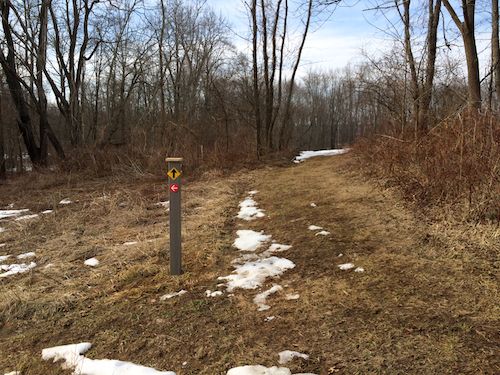
As you walk down the path from the parking lot at Crow’s Nest to the Creek Trail, you will now find a new trail marker, and if you follow it, a new trail.
The existing Creek Trail and the the northern loop of the preserve is marked with black arrows on yellow diamonds (and yellow lines on our trail map). The new trail shown here directs you to turn south with white arrows on red circles, same as the rest of the southern loop of the preserve (red lines on our map).
This trail leads back between the visitor center barn and the creek. Initially it started out as a trail used to monitor bluebird boxes and to lead out of the “natural playground” we use with kids’ programs. Now it also passes along the creek to Harmonyville Road. If you then (carefully!) cross the highway bridge there and turn down the farm lane and follow the arrows you can access the Deep Woods and Fox Hills trails at the southern end of the preserve.
At this writing, the Creek Trail is a muddy mess, so these other trails are highly recommended.
This new trail doesn’t yet show up on our printed trail maps but it open and maintained.