
Crow’s Nest: More water.
By Daniel Barringer, Preserve Manager.
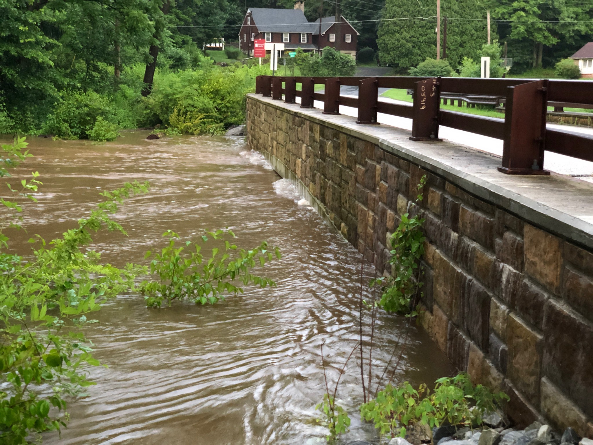
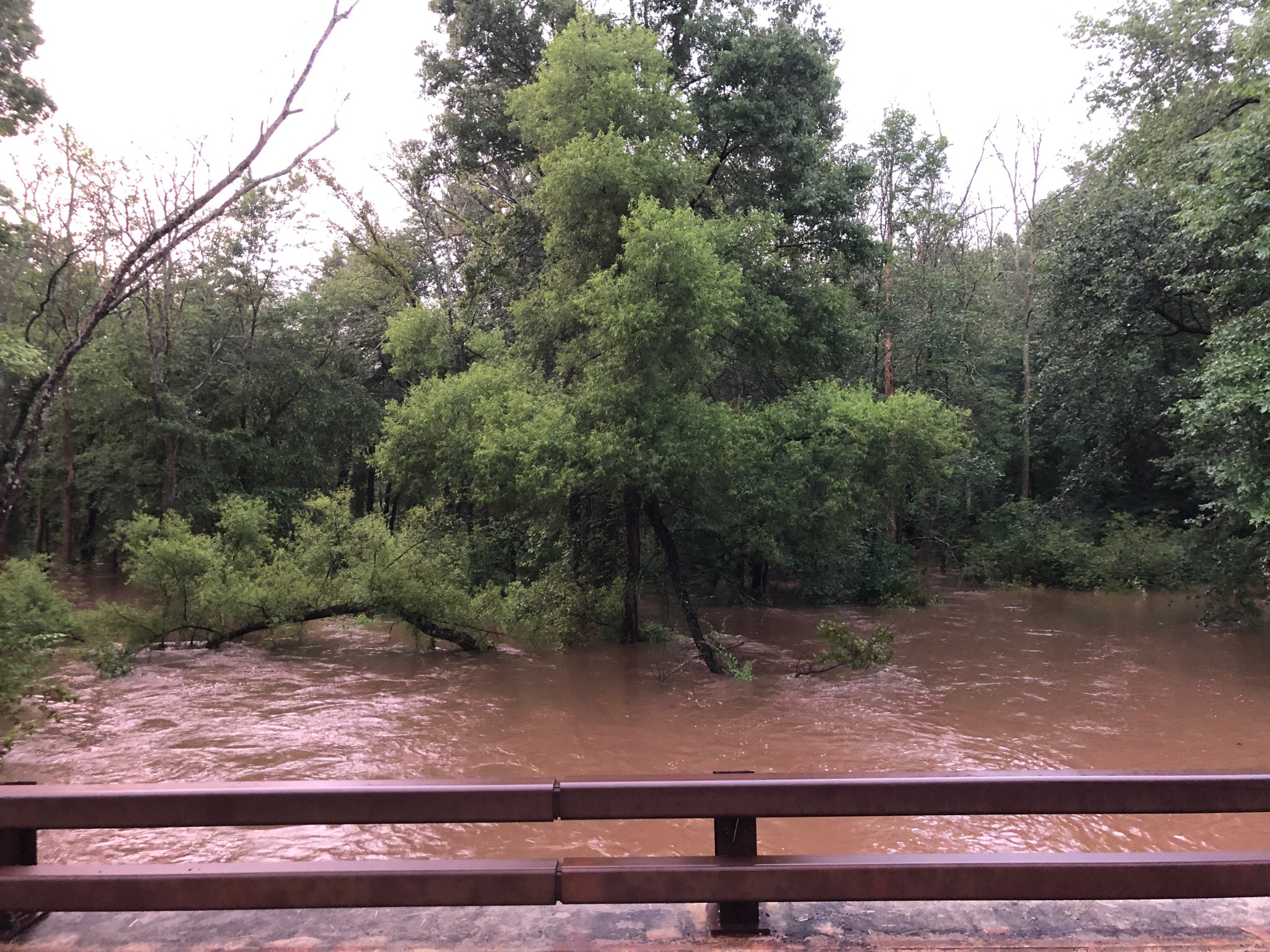
Last week’s rain was phenomenal. The official rain-gauge data for our neighborhood was 4″, though I had 7″ of water in a bucket I left out. Most neighbors said they couldn’t recall the creek having flooded this much, at least when the ground wasn’t frozen. Above is Harmonyville Road at French Creek. Not much more water could fit under the bridge, so the creek spread wide into farm fields, pastures, and wetlands (that’s one good reason to have them in the floodplain). Below, looking upstream toward the island, completely submerged. At peak rate, the rain fell at 2″ per hour.
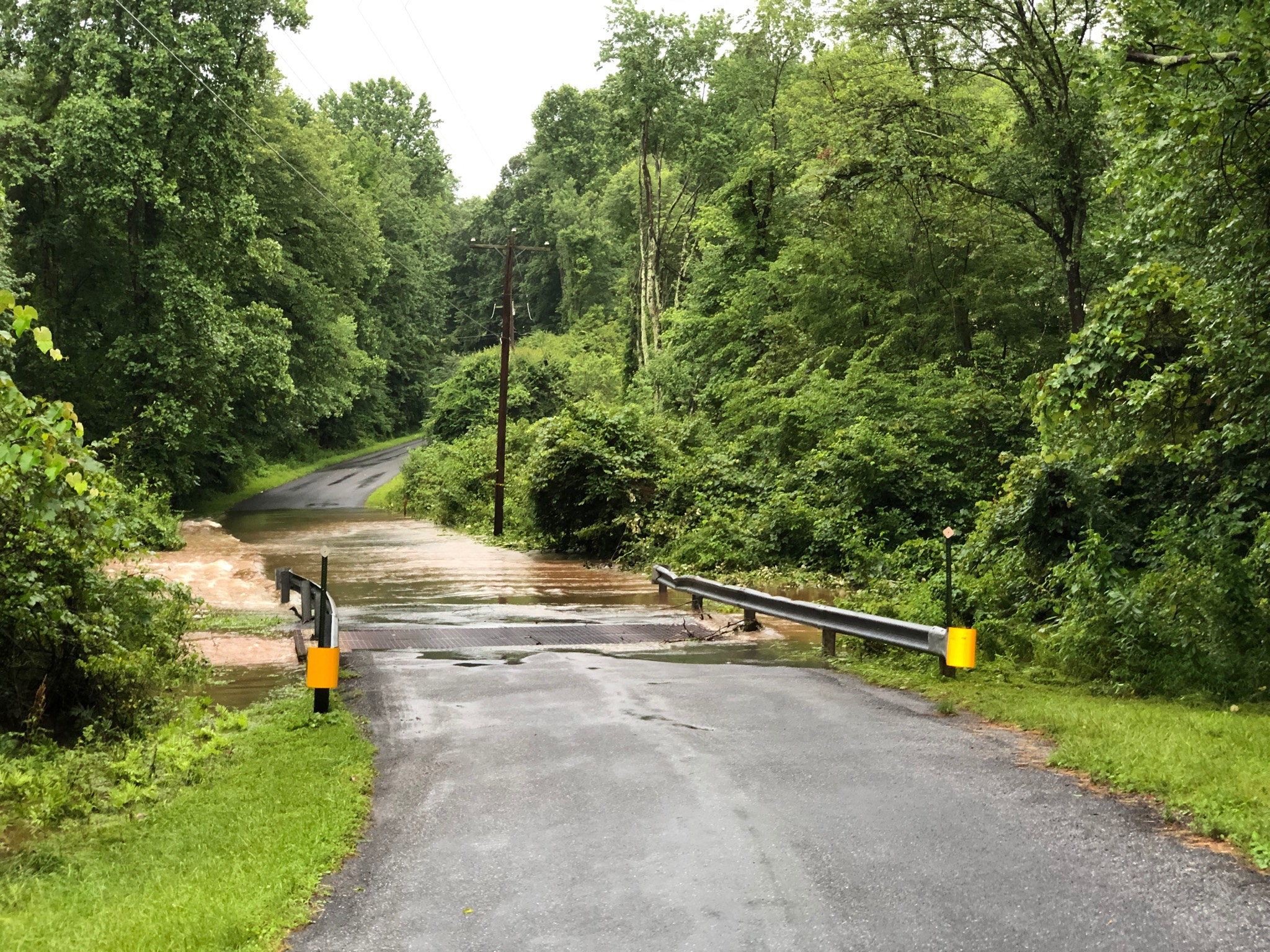
Below, the open grate bridge on Bethesda Road was slightly under water. But the roadside adjacent was under even more and it was moving fast. I didn’t dare drive through that.
With that much rainfall, most of it washes away. There’s no place to store it and the ground can’t soak up any more. So the crest peaked and by the next day the fields were dry enough for the farmer to mow hay (and he can’t afford to give up any dry day, there are so few of them). In other words, 4 – 7″ of rain didn’t make the local geography here any wetter after a day passes than 1″ does.
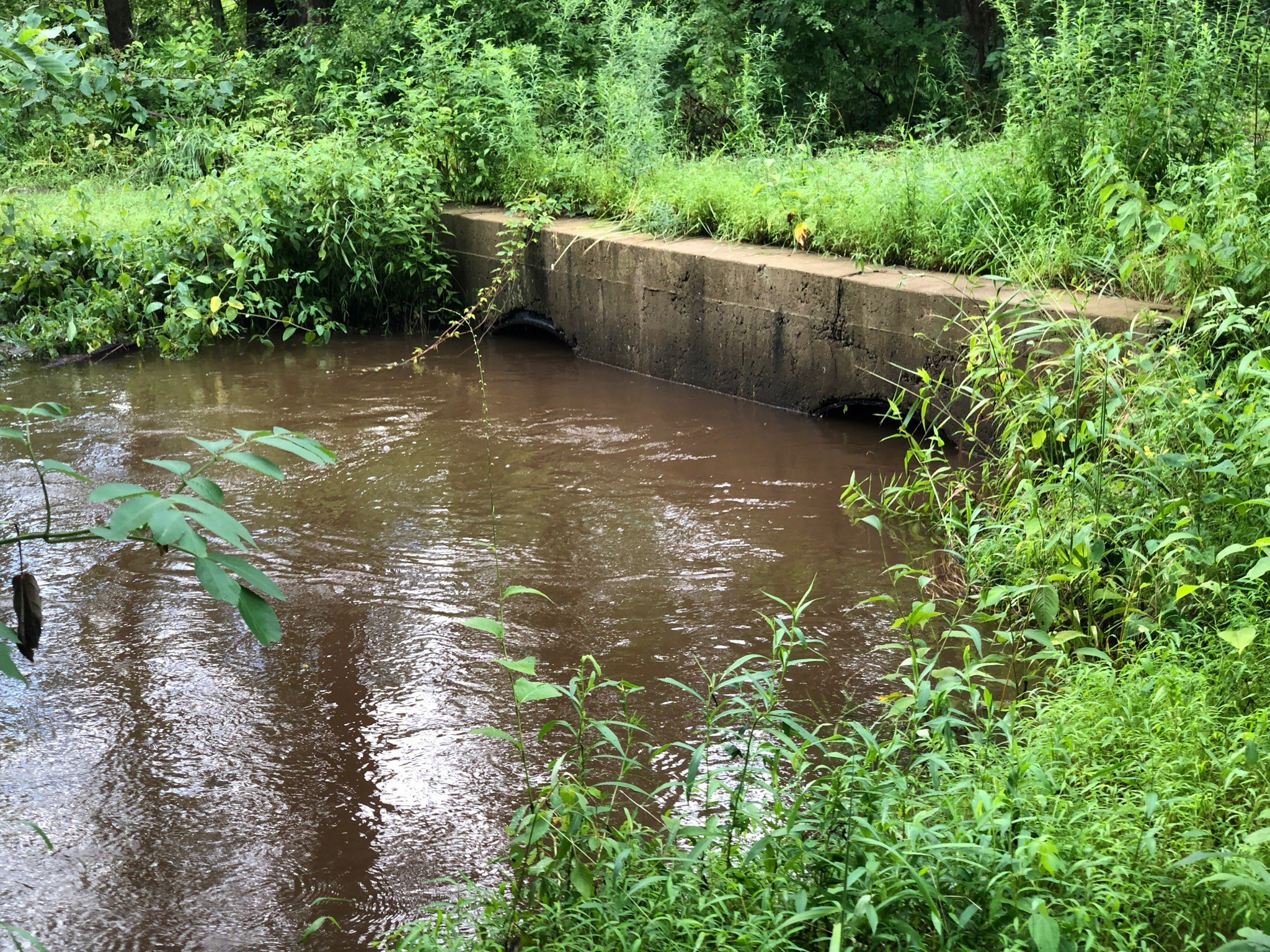
Then this week, we had two more days of rains with a very high rate, at least 1″ per hour. So the Creek Trail and many other places flooded again. Below is our culvert that takes the tractor path over French Creek at the north end of the Creek Trail. This culvert was designed to survive being submerged without damage, and it has been submerged, so this is not as bad as it looks. But the Creek Trail is under water again, in places indistinguishable from the creek.
How extraordinary is this rain? By my calculations we’ve had 20% of our annual average rainfall in just 2% of the year (one week).