
Crow’s Nest: New trail map debuts
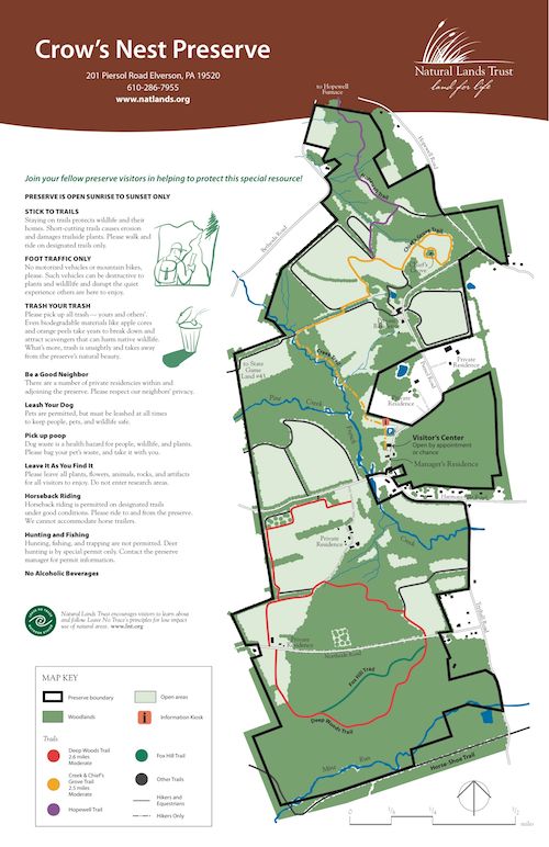
We have revised and updated our trail map and brochure and changed the color-scheme of our trails. The trails are located in the same place, but they have been organized into two main loops: one to the north and one to the south. The new trail map is in full color so it should be more legible. The Creek Trail, Farm Fields Trails, and Chief’s Grove Trail make up the yellow loop to the north (2.5 miles if you do them all, though you can peel off at a couple points to return to the parking area). And the Deep Woods Trails are combined into a loop to the south of Harmonyville Road and marked in red—a 2.6 mile loop in total.
Here are the 2000, 2005, 2008, and 2012 versions of our trail map:
The new trail on the ridge above the Deep Woods Trail is now the Fox Hill Trail (green arrows) and the trail that connects to Hopewell Furnace’s trails is marked with purple arrows. Some of the service roads and spur trails are marked with white markers (black arrows on a white background).
Here’s a scaled-down picture of the new trail map.
The new trail arrows look like this:
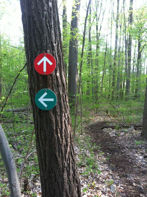
Once the changes were made on paper I had to go around and switch the arrows from the old color scheme to new, a process that has taken many hours over the last few weeks.
We hope you find the layout more logical, and the change not too confusing. Please give us feedback from your visit!
Posted by Daniel Barringer on June 8, 2012.